
The Wild Pacific Trail in Ucluelet only runs about 8 km, but is ‘wild’ as promised, with wide open vistas of the Pacific Ocean and beach access at several points.
 Free walking sticks for the trail.
  A small lighthouse on the 2.6 Loop Trail.
  Sunlight flaring through through the trees.
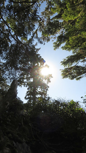 Tangle of trees on the trail.
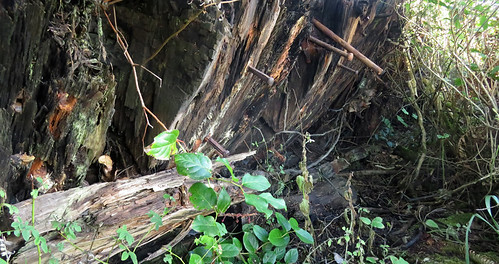
 When I first saw this it seemed to be more than just driftwood; then I saw a sign saying it was the remains of the Big Beach Mystery Shipwreck, probably from the late 1800s.
 At many places the trail opens up to vistas of the ocean.
  Natural arbour.
 Driftwood on the beach.
 Blocked stairway.
 The skeletons of dead trees.
 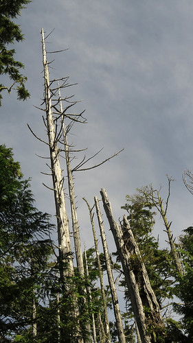 Blue Jay made of driftwood.
 Another place where the trail opens up. I love the hand-made railings.
 And another fun sign…
 Map of Vancouver Island going from Parksville or Qualicum Beach on Hwy 4 to Tofino, Ucluelet and the Pacific Rim National Park.

- A complete map of the trail is available at: http://www.wildpacifictrail.com/map.html.
- Tofino, a Small Paradise on Vancouver Island

- Tonquin Trail, Leading Down to the Ocean in Tofino. This is listed as one of the best place s to watch the sun set in the long summer evenings. But pack a flashlight or headlamp. There is no lighting on the trail and it can get impossibly dark after sunset.

- Long Beach in the Pacific Rim National Park – Layers of Sand, Water and Light

- Ucluelet, a Transitioning Fishing Village

- The Rainforest Trail, a series of boardwalks running through an Old Growth Forest.

- Long Beach in the 50s.

- From the web site Tofino Hiking, a map of all the hiking trails in the area with directions, distances and elevation gains: https://www.tofinohiking.com/hikes/
- More on Travelling around BC.
- More of Cee’s Fun Foto Challenge: Walks, Trails, Sidewalks.


Oh what fun photos you have for this week. 😀
Such a wonderful place indeed 🙂
Pingback: The Fishing Village of Ucluelet, BC | Albatz Travel Adventures·
Pingback: The Rainforest Trail in Pacific Rim National Park, Canada | Albatz Travel Adventures·